File:Land-Ownership-Auburn-IL-1916-W-B-Church-Cora-Church.jpg
From MouserAncestry

Size of this preview: 510 × 600 pixels.
Full resolution (2,551 × 3,000 pixels, file size: 1.25 MB, MIME type: image/jpeg)
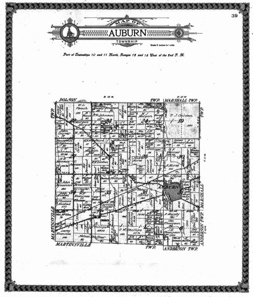
Land ownership map for Auburn Twp., Clark Co., IL, showing parcels in the lower-right quadrant for Cora Elma Church and possibly Uzziel B. Church.
File history
Click on a date/time to view the file as it appeared at that time.
| Date/Time | Thumbnail | Dimensions | User | Comment | |
|---|---|---|---|---|---|
| current | 16:35, 25 November 2012 | | 2,551 × 3,000 (1.25 MB) | Mouser (Talk | contribs) | Land ownership map for Auburn Twp., Clark Co., IL, showing parcels in the lower-right quadrant for Cora Elma Church and possibly Uzziel B. Church. |
- You cannot overwrite this file.
- Edit this file using an external application (See the setup instructions for more information)
File usage
The following 2 pages link to this file: